April Heatwave Across Minnesota – Flood Warnings Bayfield Area for Rapid Snow Melt
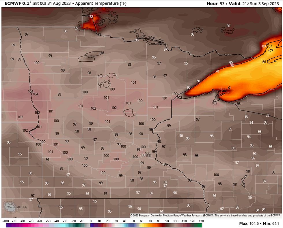
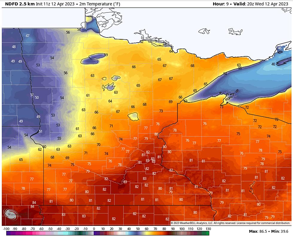
This is about as good as it's going to get for at least the next week or two. Mid 60s later today with a shot at 70 degrees well inland. Considering how much snow is lurking out there this is nothing short of a meteorological miracle! The Twin Cities may see record-breaking warmth later today (record high is 83F set in 1931) after reporting 81 degrees in the shade yesterday. By the way, Minneapolis-St. Paul went from first 50 to first 80 in the span of 9 days, the 4th fastest such spring warm-up since the late 1800s.
A sudden summer-like temperature spike is melting a lot of snow in a hurry, and a Flood Advisory is posted for much of the Northland, with Flood Warnings issued by the Duluth National Weather Service for the Bayfield, Wisconsin area. In the short term the greatest risk of highway, stream and basement flooding appears to be over the South Shore of Lake Superior in northern Wisconsin. Here are details:

In the short term the greatest risk is Bayfield and Douglas counties in northern Wisconsin, but as snow melt accelerates in coming days the area impacted by flooding concerns will almost certainly expand. A Flood Advisory issued for much of the Northland highlights the areas of greatest concern:

Flooding is very much top of mind, and additional rain late Friday into Saturday will accelerate snow melt and increase the flood potential even more by early next week. I don't see significant snow as temperatures cool off again, but a coating to an inch or two of slush can't be ruled out Saturday night into Sunday:

I will be so happy when I no longer have to show snowfall accumulation maps. Like most everyone else, I'm ready to turn the page and start complaining about bugs, humidity and summer thunderstorms ruining my weekend plans.


After balmy skies today, we are in for a minor reality check next week with a string of 40s for highs, closer to average for mid-April.
A Northland spring is always two steps forward, one step back. Or is it one step forward and two steps back? I honestly can't remember. At least we're getting a taste of relative warmth. Spring is coming - but it's in no particular hurry this year.
Yellowstone National Park Rebuilds After Historic Flooding
More From KOOL 101.7