Sizzling September: 100F Heat Index Here Sunday While Category 4 “Idalia” Batters Florida
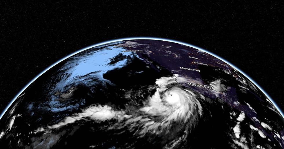
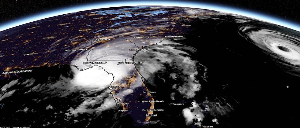
I am counting my blessings, atmospheric and otherwise. Category 4 Hurricane Idalia is chewing up the Florida coast this morning with sustained winds of 130 mph, with severe flooding pushing across the Florida Panhandle into Georgia and the Carolinas. In all probability Idalia will become yet another billion-dollar disaster to strike the US.
According to the AP, Atlantic storms beginning with the letter “I” have been the most destructive since 1955. The National Weather Service in Tallahassee has called Idalia “an unprecedented event.” Idalia “stands a chance of setting a record for intensification rate because it’s over water that’s so warm,” said MIT hurricane professor Kerry Emanuel. Water temperatures in the Gulf of Mexico are in the mid to upper 80s, jet fuel for storms that get their ferocity from warm ocean water.

On a mosaic of Doppler radars from NOAA you can see the size and scope of Idalia's spiral bands feeding into the center of the storm, which is pushing into the Florida Panhandle as we speak. The worst conditions and greatest threat to life and property will come this morning and midday.


The National Hurricane Center pushes a rapidly-weakening Idalia along the Carolina coast later today and tonight, with more coastal (storm surge) flooding and heavy rain sparking flash flooding well inland. Tens of millions of Americans are being impacted by Hurricane Idalia.

The greatest threat to life and property from hurricanes doesn't come from high winds, but from the "storm surge", a battering-ram of water pushed inland by the combination of low pressure and high winds. A surge of 12-16' is likely in the Big Bend area this morning, but moderate coastal flooding will impact the Carolina coast as well. As much as 6-8" of rain from Idalia will trigger severe flash flooding well inland, but the storm shows no sign of stalling, which would create an even bigger catastrophe.

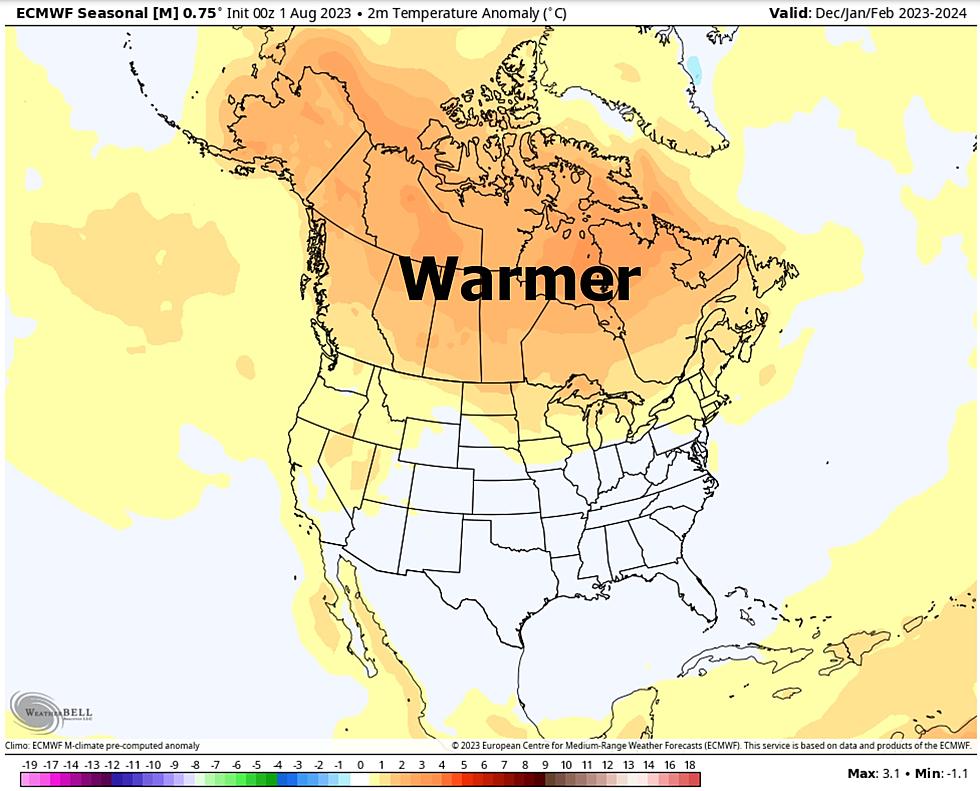
September 1 marks the beginning of "Meteorological Autumn" but Mother Nature doesn't appear to have gotten the memo. A late summer heat dome will spark near-record heat close to home from Saturday into Tuesday of next week. Peak heat may come Sunday with a heat index close to 100F, even close to Lake Superior in the immediate Twin Ports.

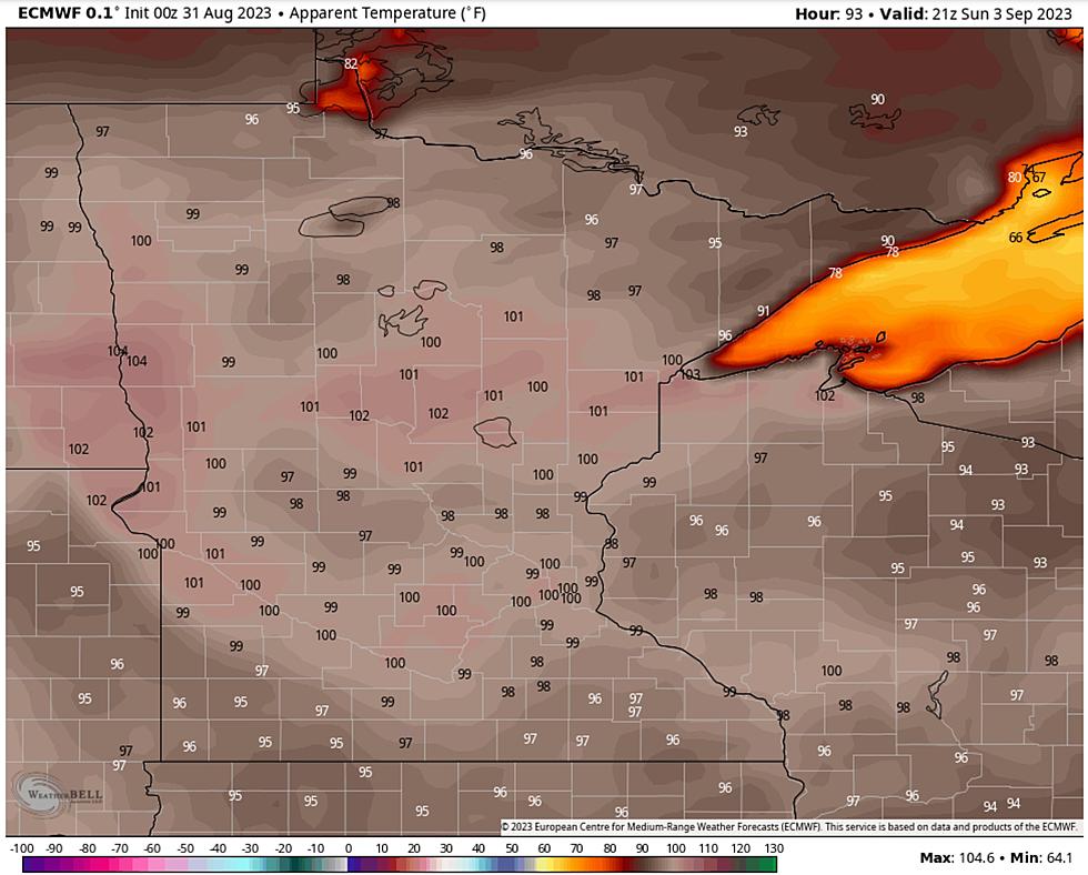
Heading down to the Twin Cities for the Minnesota State Fair this weekend? Pack your short shorts and a few extra bottles of water to stay hydrated. An air temperature of 100F is not out of the question Sunday, again Monday afternoon. Good grief.

The map above from ECMWF (European weather model) shows a heat index close to 100F by late afternoon Sunday, which may be the hottest day of the holiday weekend. A very lake-worthy stretch of weather to end the official summer of '23, but I have a feeling unusual warmth will spill into late September as a Super El Nino ramps up.
Smoke, heat, general discomfort? I guess I can live with that. No storms with names are approaching Minnesota or Wisconsin. Pick your poison, but there are benefits to living over a thousand miles from Hurricane Alley.
25 costliest hurricanes of all time
More From KOOL 101.7