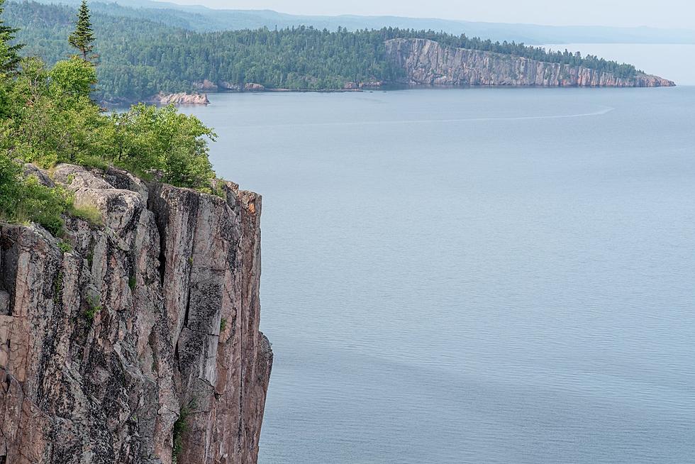
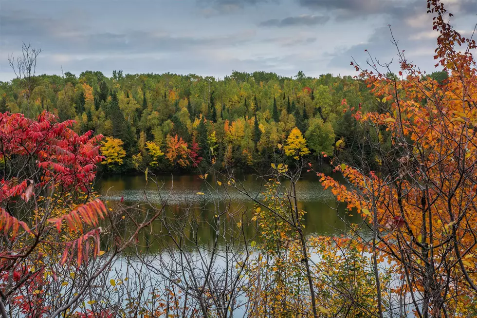
We live in one of the most gorgeous areas year-round, and it only gets better in fall. The varied terrain, water, and multitude of types of trees make for an explosion of color people travel from around the country to enjoy. With so many places to pick from, sometimes it can be hard to decide where to go. We decided to assemble some of the best drives around the region to take in the fall colors from your car; many of them with plenty of options (or reasons) to get out and hike around. These are definitely not the only ones, but they're some great starting options.

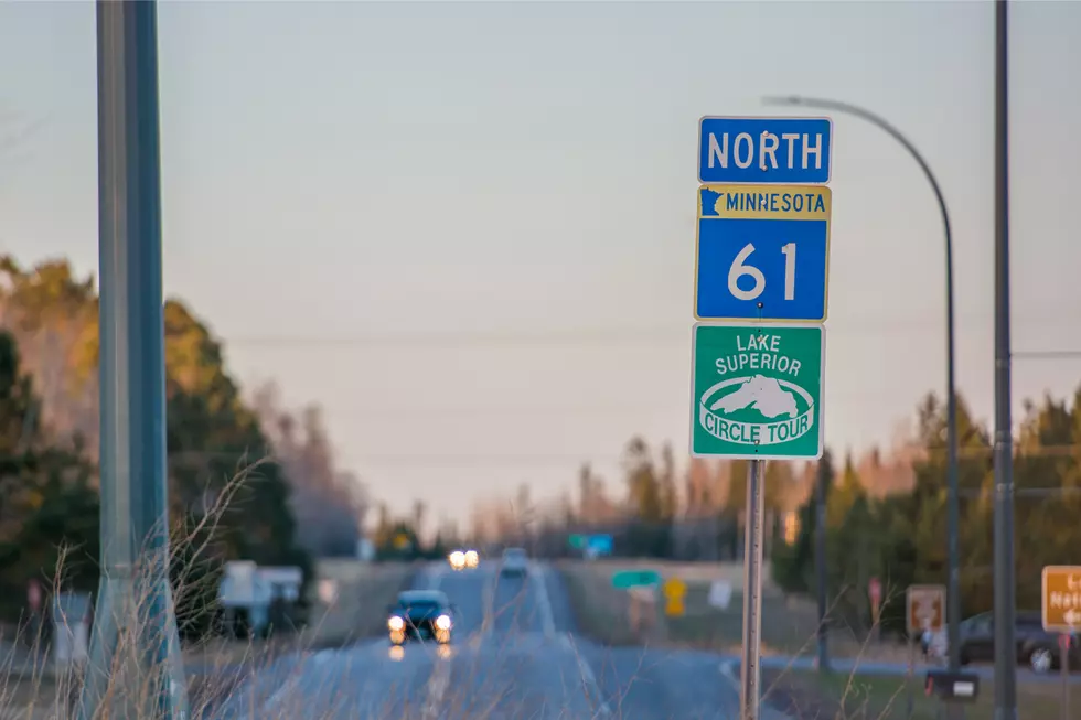
We have all the routes on this interactive map, plus we break them down individually below.

  • Iron Range Loop

    66 Miles (1 hour, 17 minutes)

    Tour the unique Iron Range terrain (including a trip across Minnesota's newest and highest bridge). A beautiful mix of trees is accompanied by opportunities to get out of the car and walk around at the Soudan Underground Mine and the US Hockey Hall of Fame, among others.

    Head north out of Virginia on US 53, then follow Highway 169 to Tower. If you're looking to really extend your adventure (or make it an overnight affair), you could continue along Highway 1 up to Ely, which offers a number of additional fall adventures. If you're looking to keep things brief, you can head south once again from Tower toward Biwabik, and eventually back to Virginia once again.

    Google Maps
    Google Maps
    loading...
  • Sawbill/Grade/Caribou Loop - Oberg Mountain

    58 Miles (2 hours)

    This drive will take you into the heart of inland Arrowhead Minnesota, giving you one of the best chances of all of these routes to see moose, deer, and other wildlife. You'll see a blend of leafy and pine trees and a number of waterways that may offer great reflective photography opportunities. Note that there are alternate road options that can shorten this loop if you'd like to spend a little less time touring.

    One additional perk of this route is that you have the chance to hike the Oberg Mountain Trail, which offers a famous, incredible view of Oberg Lake. Just turn off of MN 61 onto Onion River Road and head up the hill. There is a well-marked parking area at the trailhead. Do note that fall is a very busy time, so going on a weekday will help you avoid crowds and parking issues. The hike is a little over 2 miles round trip, and does offer a light challenge due to a climb in elevation, but most able-bodied children and adults will be able to hike this trail if you take your time. It's well worth the walk!

    Google Maps
    Google Maps
    loading...
  • Seven Bridges Road/Skyline Parkway

    25 Miles (1 hour, 11 minutes)

    You don't need to leave the Twin Ports to enjoy an incredible fall leaf tour. Duluth's very own Skyline Parkway and Seven Bridges Road (extending from Becks Road all the way to Lester River) offers amazing panoramas of Lake Superior as well as the cities of Duluth and Superior.

    One could easily make a full day adventure out of this tour, making stops to hike around in Amity Park, at Hawk's Ridge, Chester Park, Enger Park, and Bardon's Peak Overlook (one of my personal favorites) to see a panoramic view of much of Duluth and Superior from near Spirit Mountain. Many of the trails near the Magney-Snivley Trailhead also offer hikes covered by a canopy of vivid leaves and small streams running down the hillside.

    Google Maps
    Google Maps
    loading...
  • Two Harbors-Beaver Bay Loop

    52 Miles (1 hour, 6 minutes)

    Enjoy some of the backcountry away from Lake Superior without making the trek all the way up the North Shore. See a forest blend of various leafy and pine trees along the route, which also features two of Minnesota's most famous state parks. Both Split Rock Lighthouse and Gooseberry Falls State Park are along this route. Both offer wonderful views of their key attractions, with a backdrop of colorful leaves to make for awesome selfies or photos with minimal required hiking.

    Google Maps
    Google Maps
    loading...
  • Heartbreak Ridge Loop

    18 Miles (32 minutes)

    This shorter, Minnesota-shaped route anchors itself around Temperance River State Park. Check out the waterfalls along the Temperance River and look for the roadside plaque on this loop that explains how Heartbreak Ridge was named. See a timelapse video of some of this route here.

    While this is the shortest route on this list, it is certainly not one to overlook. You could easily pair it with another one or two of the routes and make a day of it. This route actually shares a little roadway with the Sawbill/Grade/Caribou Loop on this list. You could easily continue your adventure on this route, or simply head a couple miles north to Lutsen, where you can enjoy some incredible views from the ground, or from above on Lutsen's Gondola, which gives you a scenic ride to the top of Moose Mountain, rising 1,000 feet over Lake Superior. There are also some hiking trails, and their alpine slide is open well into the fall as well.

    Google Maps
    Google Maps
    loading...
  • Maple Hill – Trout Lake Loop

    33 Miles (1 hour, 5 minutes)

    While this is another of the shorter routes, it is easy to spend plenty of time in Grand Marais enjoying the quaint small town atmosphere, fun shops, and tasty food and beverages. If you've never been, I definitely recommend taking a walk out onto Artist’s Point and to the Grand Marais Lighthouse. It will give you a sweeping panoramic view of the city and hillside that is so iconically Grand Marais.

    When you're ready to hit the trail, head up the hill. If you're looking for a unique photo opportunity, Take a left onto Maple Hill Drive to check out the old Maple Hill Church, which is set in a wooded area surrounded by maple trees.

    The rest of the loop takes you onto the early reaches of the Gunflint Trail. If you're feeling adventurous, there are a number of side roads and trails off the Gunflint that you can explore for even more wilderness viewing. This route, as mapped out, is a favorite among many that visit the area.

    Google Maps
    Google Maps
    loading...
  • Delta Loop

    81 Miles (2 hours)

    This figure-eight loop will lead you through some of Northern Wisconsin's many forests and wilderness areas that are part of the Chequamegon-Nicolet National Forest. Wind through the lake-dotted forest area with two chances on this route to stop by the famous Delta Diner, known for their retro roadside diner motif.

    This loop offers several chances to expand or shrink your adventure, simply by altering your route. For example, you could head directly from Drummond to Grand View to shorting your trip, or head even further south into the National Forest to explore even more.

    Google Maps
    Google Maps
    loading...
  • Bayfield Loop

    148 Miles (3 hours)

    This is the granddaddy of the drives on this list in terms of distance, but the payoff is well worth it! Start your journey with a blend of farms and forest along Highway 13, eventually giving way to forests and Lake Superior shoreline.

    The pinnacle of this loop is at the other end, along Chequamegon Bay. Seeing sailboats against a multi-colored shoreline and vibrantly colored islands dotting the bay makes almost any picture you take postcard-worthy.

    Bayfield is famous for their annual apple festival, which sees thousands of people coming to town for one weekend every fall. While the festival is a lot of fun, you can also enjoy the same incredible scenery and apple-filled fun during most of the fall season. Walk down the streets, check out the shops, or enjoy some waterside dining at one of the many places to grab a bite to eat, like the Pier Plaza Restaurant.

    A number of other small towns along the shoreline offer other opportunities to stop and walk around, with nearby Ashland offering a number of additional dining and adventure options. My personal favorite place to grab a meal and a beverage in Ashland is the Deep Water Grille, which features Ashland-brewed South Shore Brewery Beer.

    While many of these loops and routes can be started and finished in no particular order, I recommend taking Highway 13 East, and Highway 2 back. While scenic, Highway 2 isn't nearly as scenic as the first part of the route, and it will allow you to get home quicker after a long day.

    Google Maps
    Google Maps
    loading...
  • Lax Lake Loop

    32 Miles (39 minutes)

    Anchored by Tettegouche State Park, this shorter route offers chances to enjoy waterfalls and hiking within the park, as well as a gorgeous view across Lax Lake on the west side of the park.

    Hike to the tallest waterfall totally within the state of Minnesota. Known as High Falls, it comes in behind only the Pigeon River High Falls, which straddles the Minnesota/Canada border. Along with the 70-foot tall Tettegouche High Falls, you can also hike to the 40-foot Illgen Falls further upstream along the Baptism River.

    Google Maps
    Google Maps
    loading...
  • Pleasant Valley - Pattison Park Loop

    53 Miles (1 hour, 11 minutes)

    Another close-to-home route that offers variety, and some of the best little-known scenery in the Twin Ports Area. Heading south on Highway 23 out of Gary New Duluth, your first major discovery will be a scenic overlook at the intersection of Highway 23 and Line Road. Stop and look out over the St. Louis River Valley into Jay Cooke State Park. Much of this valley will be highlighted with brightly colored trees in peak season, offering a unique view of the park. You'll also see some of the scars left behind by the 2012 flooding that damaged much of the park, including the famous swinging bridge.

    From there, head into the Pleasant Valley area, which features a blend of forested areas and farms dotting the landscape. Eventually you'll head eastward, into Wisconsin. The other key highlight of this loop is Pattison State Park, which will afford you the opportunity to do some hiking and check out both Big Manitou Falls and Little Manitou Falls, along with some great scenery. From there, it is just a short trip back to the Twin Ports.

    Google Maps
    Google Maps
    loading...

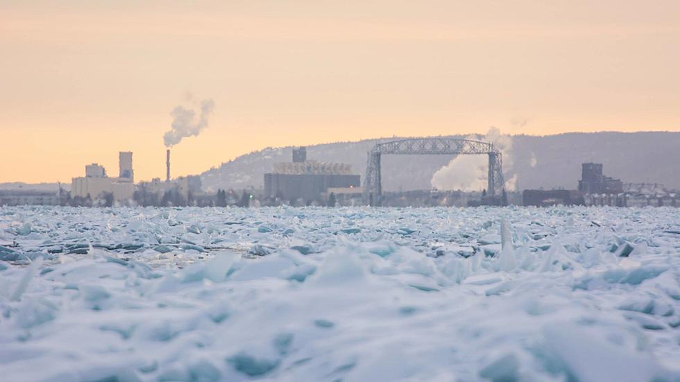
More From KOOL 101.7