Highly Unusual May Climate Extreme Across Canada Responsible For Choking Wildfire Smoke
Much of the nation is gagging, hacking and coughing its way through some of the worst wildfire smoke ever recorded so early in the summer season. Air quality ranges from poor to unhealthy to downright hazardous (dangerous) across much of the US, especially the Mid Atlantic region, where air quality indexes (AQI's) in excess of 400 have been observed in recent days. What is going on? Why is it so bad - so early? One map sums up why we are where are today:
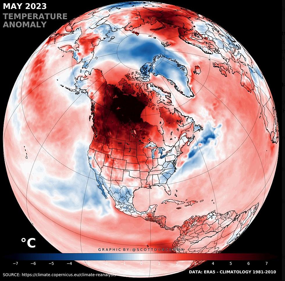
Record heat baked much of Canada last month: unusually hot and dry so early in the season with temperatures 20-30F above average for an extended period of time. On Twitter, Scottish meteorologist Scott Duncan, based in London, wrote: "Extreme and prolonged hot and dry conditions in Canada are setting records and making it effortless for wildfires to rage. Canada was at the epicenter of the most significant heat anomaly on the planet in May."
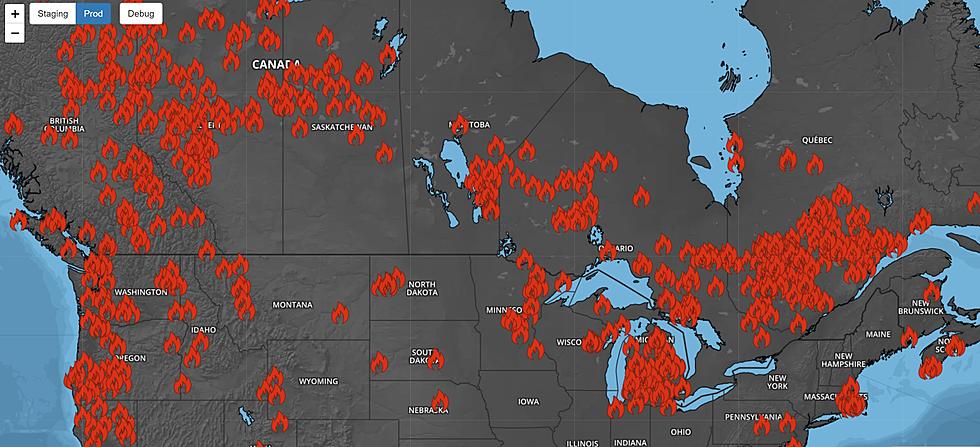
Record heat dried out much of Canada during what is normally a cool and wet period, setting the stage for today's wildfires. Many of these blazes were started by lightning, and are now difficult for firefighters to reach. High winds and low humidity have hampered fire fighting efforts, creating a ripe environment for flames and smoke - forcing tens of thousands of Canadians from their homes.


Over 4 million acres of land across Canada has already gone up in smoke, and the graph above shows just how unusual (and statistically bizarre) 2023 has been. Historically, wildfire season runs from July into September. Not this year.

For much of Wednesday, New York City had the worst air of any major city on the planet, and that plume of dirty air from Canadian wildfires pushes into Baltimore and Washington D.C. today. All this from fires hundreds of miles away. Weather systems are stalled, locked in a rare holding pattern, which means some of that smoke may drift westward across Wisconsin into Minnesota later today and Friday.

Increasingly, it appears this will be a summer of heat, drought and smoke for much of Canada and the US. The pattern may yet shift into something cooler and wetter, but a brewing El Nino warm phase of the Pacific increases the probability of warmer and drier weather for Canada and the northern tier of the USA into the fall and winter months.
As always, the future is uncertain, but reading atmospheric tea leaves, there is little doubt we'll be dealing with occasional outbreaks of wildfire smoke for the rest of the summer and early autumn. And if anyone asks, a steadily warming climate increased the statistical odds of last month's crazy temperature extremes across Canada, which has resulted in historic, unprecedented fires from coast to coast.
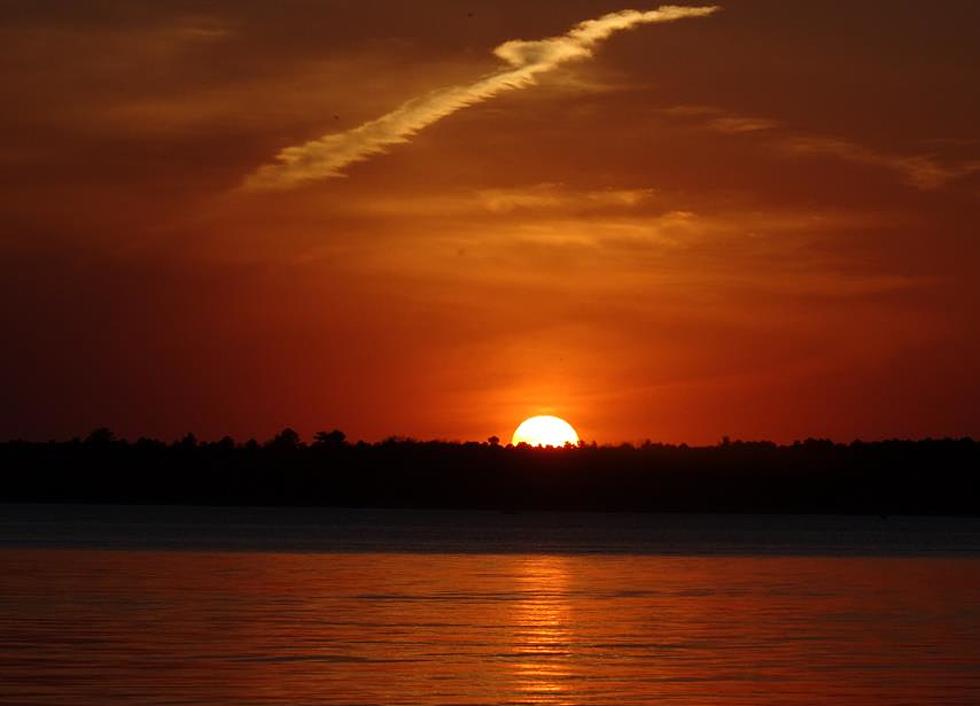
Climate change may seem vague and nebulous, always happening somewhere else. But in the coming days, weeks and months you will see the effects of dramatic warming outside your window as smoke creates a perpetual orange-haze many days.
I'm hoping for a pattern shift and a rainy rest of the summer, but I have my doubts.
Everything is interconnected. 2023 is Exhibit A.
Crazy Pictures From Smoke Filled New York State
Gallery Credit: Rob Banks
More From KOOL 101.7