Northland’s Hottest Days Coming in September – Where Will It Feel Like 100F This Weekend?
Would someone please wake me up when our weather patterns "make sense"? That won't happen anytime soon, after staring at the weather maps and models. The Northland has experienced a relatively comfortable summer season, to date - a few warm(ish) days but no extended periods of debilitating, rabid heat.
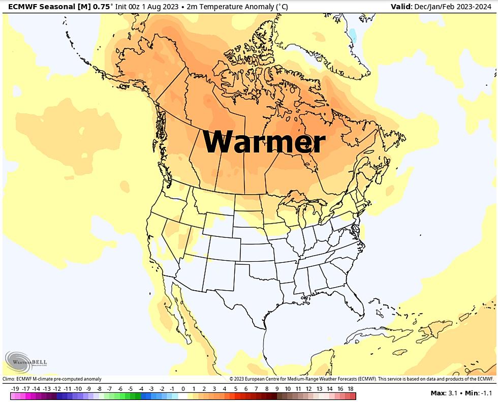
That's about to change. What may very well be the hottest temperatures of 2023 will push into town; a rare, early-September heatwave with records likely across both Minnesota and Wisconsin. What makes this even more bizarre is the fact that if you look at the data, the warmest 90 days of summer is behind us now. Meteorological Autumn kicks off September 1. As far as the atmosphere is concerned it's already fall! Well, most years - but not this year, with much of the planet overheating.
More evidence of weather weirding? Perhaps. It's probably a combination of factors, including natural variability, background warming due to greenhouse gas emissions and a Super El Nino kicking in is helping to amp up the heat.
If it's any consolation this odd, late-season heat dome won't stick around for long with maybe 3 unpleasantly hot days, even near Lake Superior, followed by a cooler correction next week. But Sunday may take your breath away. Literally.

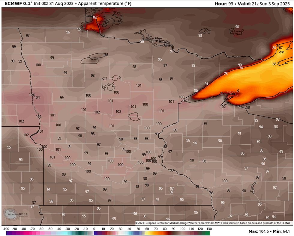
Daytime highs in the Twin Ports may be 20-25 degrees F. warmer than usual by Saturday and Sunday, and high humidity will make it feel like upper 90s to near 100F, especially on Sunday - when heat should peak.
Heading down to the Minnesota State Fair in lovely Falcon Heights? Pack your short shorts and make it a point to stay hydrated with something other than tasty beer. The heat index Sunday in St. Paul may rise to 105F by late afternoon.
Is this a meteorological omen, a preview of a toasty autumn to come? Probably. Based primarily on a developing El Nino, I would wager a small amount of money on warmer than average temperatures spilling over into fall and winter.
I suspect the upcoming winter won't look anything like last winter with 140" of snow.
Expect the unexpected and good luck keeping your cool in the coming days!
10 Gadgets to Help Your Pet Beat the Texas Heat
More From KOOL 101.7