
FEMA Updates Floodplain Maps For Duluth + Superior, Insurance Rates Could Be Affected
Are you at risk?
Many Northlanders never give a passing thought about the potential risk that a flood could affect their home or property. Historically - and thankfully - our area hasn't seen the kind of floods that are common in other parts of the country. Because of that, the common wisdom has usually been that 'we just don't have floods here'.
Or, do we?
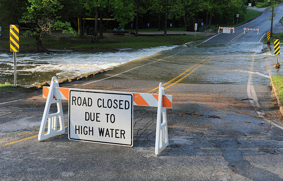
Over the last 20 years or so the Twin Ports and Northland area has fallen victim to a number of larger flooding incidents that have suggested otherwise. Perhaps the most memorable was the June 2012 flood that spread costly damage throughout our area; even if you personally weren't affected, that flood left some pretty indelible images behind. (Ex - the seal at the Zoo, damaged restaurants and businesses near the Mall, torn up city streets)
Because flooding was considered a rare occurrence in the past, probably a large number of people never bothered to insure their home or property against that sort of damage; or if they did it was perhaps "under"-insured - providing some coverage but not a realistic amount.
That flood insurance coverage was also probably pretty affordable - figuratively speaking. It only stands to reason that an insurance company wouldn't charge a higher premium for something with such a low risk factor.
Like it or not, insurance rates are established off of a combination of those risk factors and historical data. Whether or not we experience more large-scale flooding incidents in the Twin Ports area, those past events will have a forward effect on liability insurance.
One of the tools used by insurance providers are the Flood Insurance Rate Maps (FIRM), which are collected and matriculated by the Federal Emergency Management Agency (FEMA). Recently, the agency updated that map and they are allowing Northlanders their first look at how the potential risk may have changed for their property. This can be important for property owners, too because they can use that data to establish whether or not they want to proceed with obtaining flood insurance. Adam Fulton, Deputy Director of the CIty of Duluth's Planning and Economic Development Department explains:
"Many of us remember the loss and disruption of the flood of June 2012 and the cost to clean up and restore homes, businesses, roads, and stream channels. No one wants to experience that again. Having accurate maps showing landowners the risk of flooding on their property will help people prepare for the next flood."
There are a number of ways private landowners can look at that data. The easiest is via the online version of the map, which provides an interactive approach to looking at it. Right now, that Flood Insurance Rate Map hasn't been finalized. However, once FEMA does finalize it, the City of Duluth will "adopt the maps and related land use regulations".
Some background - provided by the City of Duluth: Flood insurance is required for federally-backed mortgages on structures in areas designated as a Special Flood Hazard Area and Coastal High Hazard Area. Duluth joined the National Flood Insurance Program in 1980, when it adopted its first Flood Insurance Rate Maps. Those maps establish flood zones and base flood elevations to determine the cost of flood insurance premiums.
10 Major Summer Weather Events In Northland History
10 Major Winter Weather Events In Northland History
Ways Winter 2020-2021 Was So Bizarre For The Northland
More From KOOL 101.7

