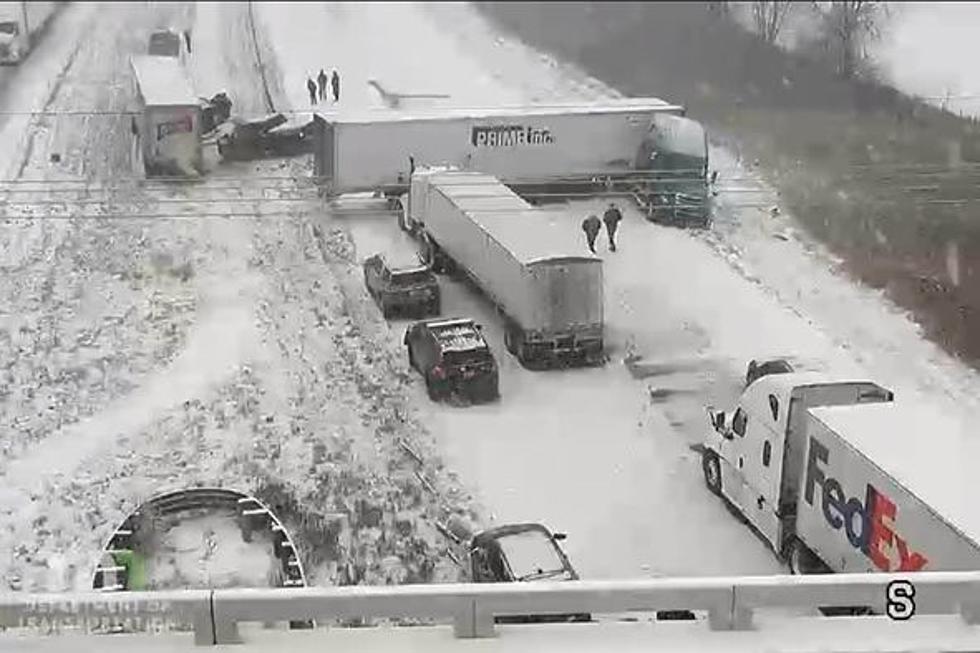
Yikes! Video Shows 9 Semis Blown Over on I-35 in Minnesota from Stormy Conditions
As stormy conditions rage across the region Tuesday, the Northland has thankfully been spared the worst of it. From massive amounts of snow possible in Bismarck, North Dakota to dangerous, windy conditions, elsewhere, it's down right nasty in parts of the United States.
One such area where the weather is wreaking havoc Tuesday is in southern Minnesota where the wind was so strong that it blew over 9 semis on I-35.
WCCO-TV is reporting that at around 2:00 p.m., MnDOT video showed semis overturned on Interstate 35 south of Faribault. According to the Minnesota State Patrol, nine semis in total were tipped over due to strong winds, but thankfully no injuries have been reported.

Can you imagine being the driver of one of the semis that was taken down by the wind? It's must've been an incredibly unnerving experience for the drivers and for the other motorists on the interstate who witnessed the strength of the weather conditions in the area.
Once this occurred, northbound traffic was stopped. Ultimately, a detour was established and the Minnesota Department of Transportation was reporting that traffic eventually began moving once again, albeit it very slowly.
While storm conditions are expected in the Northland, they aren't expected to be nearly as severe. According to our media partners at WDIO-TV, our forecast currently is:
Tuesday Night
Windy with rain likely. Low 34F. Winds ENE at 25 to 35 mph. Chance of rain 90%. Rainfall near a half an inch.
Wednesday
Windy with a steady light rain in the morning. Showers continuing in the afternoon. High 41F. Winds ENE at 20 to 30 mph. Chance of rain 70%. Higher wind gusts possible.
Wednesday Night
Rain showers early changing to a few snow showers late. Low 29F. Winds WSW at 10 to 20 mph. Chance of precipitation 40%. Snow accumulations less than one inch.
Thursday
Gusty winds. Snow showers developing in the afternoon. High 35F. Winds WSW at 20 to 30 mph. Chance of snow 50%. Higher wind gusts possible.
Not exactly prime spring weather, but today proved it could be worse. The good news is that the precipitation should be gone for much of the upcoming Easter weekend.
LOOK: The most expensive weather and climate disasters in recent decades
KEEP READING: What to do after a tornado strikes
More From KOOL 101.7


