A Gustnado Was Spotted In Southern MN – But What Is It?
Weather in Minnesota is all over the map from our brutal winters to our beautiful summers to our muggy days that often bring about storms to boot.
We are no strangers to severe weather in Minnesota, either. Our winters bring about major snowstorms and our summers bring us severe storms. Summers also bring us some interesting weather phenomena!
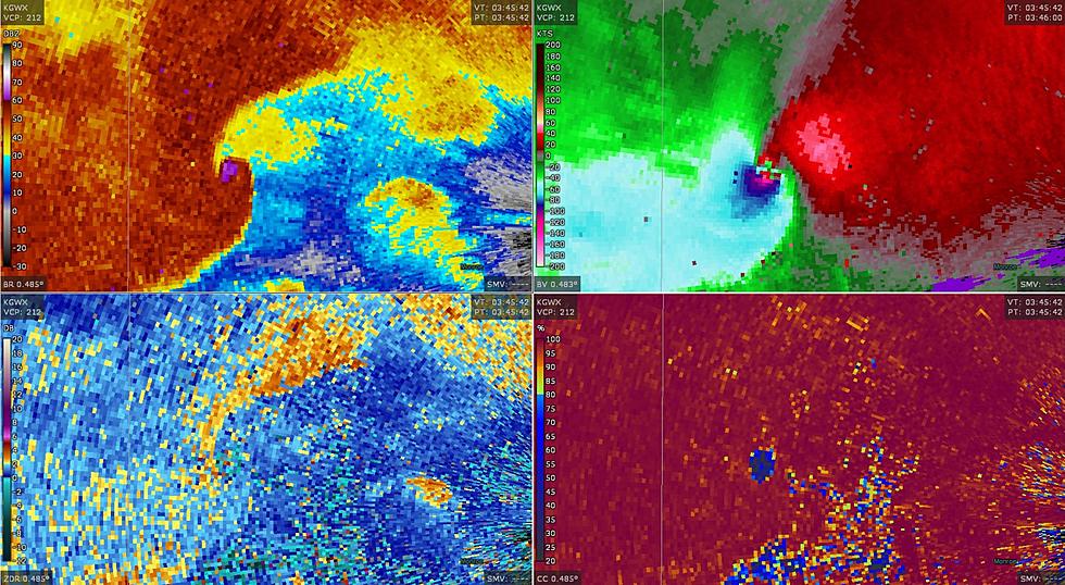
On Wednesday (June 2nd), we got our first taste of severe weather for this summer season, especially in southern Minnesota. A local news station out of Mankato, Minnesota even caught it all on camera!
So what happened? KEYC News Now shared video of a gustnado moving about in the area. Of course, we have all heard of a tornado but I personally had never heard of a gustnado so I did some research.
According to AccuWeather, the phenomena is described as the following:
A gustnado is a short-lived, ground-based swirling wind that can form on the leading edge of a severe thunderstorm.
While a gustnado may look like a tornado, they are different for many reasons. AccuWeather reports that the most notable difference between a gustnado and a tornado is that they develop differently: a gustnado develops from the ground up and isn't connected to a cloud like a tornado is.
Here are a few other fun facts about gustnadoes that I found interesting, courtesy of AccuWeather and the National Weather Service:
- The average gustnado lasts anywhere from a few seconds to a few minutes.
- Gustnadoes are not strong like tornadoes are and usually don't cause signficant damage, if any. However, a strong one may.
- Gustnadoes are accompanied by rain.
- Gustnadoes occur during thunderstorms.
I am a complete weather nerd so I am always excited to learn more about severe weather and weather phenomena!

10 Things Northlanders Look Forward To Every Summer
More From KOOL 101.7


