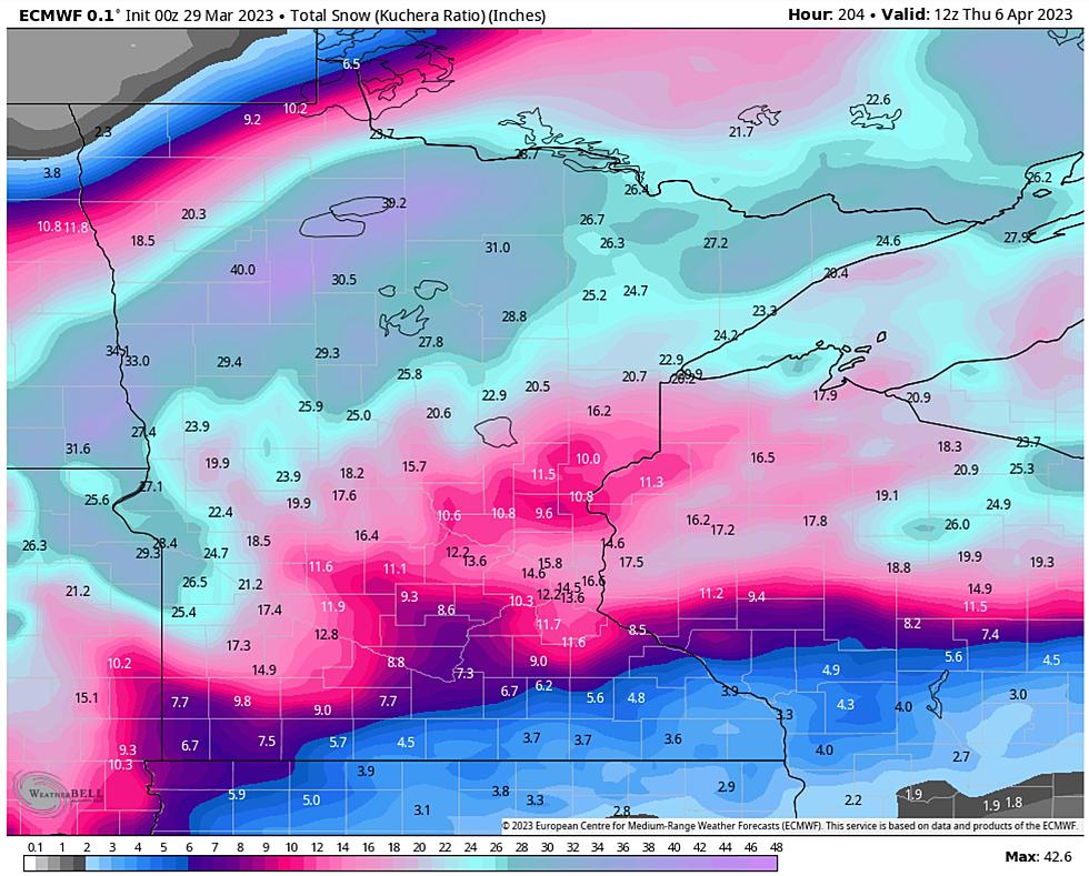
Updated Snow Forecast Calls For 12-18 Inches for Duluth / Superior, North and South Shore
The National Weather Service has been warning of a 'powerful' early spring storm, with predicted snowfall totals continuing to climb as the storm bears down on the region. Earlier Tuesday afternoon, a winter storm warning was issued for heavy snowfall in the region. Since the initial warning, predicted totals have been increased to amounts in excess of a foot.
Timeline
Moderate to heavy rainfall is expected to quickly turn to snow from North to South between 4 and 7 am Wednesday morning. The drop in temperatures could lead to some ice formation on roadways and other surfaces. Once the mixed precip turns to wno, snowfall during the morning hours on Wednesday could be up to 1-2 inches per hour at times.
Snow will continue through Wednesday, and a potential of some lake effect snow will carry over into Thursday morning.
Complications From This Storm
Due to the potential for icy roads that become snow-covered, driving conditions could deteriorate quickly. Compounding road conditions is the potential of low visibility with occasional heavy snow and possible fog could lead to visibility of less than a quarter of a mile a times.
Along with poor travel conditions, there is a potential of downed trees and power lines due to ice and heavy snow followed by wind gusting up as a part of this storm system. Be prepared for the potential of encountering downed trees or power outages during this storm.
More From KOOL 101.7